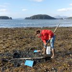
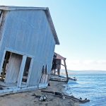
For two summers, Goodnews Bay students engaged in hands-on, professional science to benefit their community. They used ground-penetrating radar, peat corers and GPS to calculate the effects of climate change in their western Alaska village. They assisted researchers on a project to assess Goodnews Bay’s ability to adapt to flooding, erosion and other hazards associated with a warming planet.
The researchers are Chris Maio, University of Alaska Fairbanks geoscientist, and PhD graduate student Richard Buzard. Buzard used decades-old military and NASA aerial surveys and modern geographic information system software to measure how the shoreline has changed over time. Maio focused on sediment cores, among other things.
Having local students and residents trained to measure coastal erosion will help the community down the road, said Maio. “They’ll be able to do it all on their own prior to and after major storm events,” he said. Maio and Buzard concluded that Goodnews Bay is fairly resilient to the effects of climate change.
Maio and Buzard are working on another Alaska Sea Grant–funded project in 10 villages in the Bristol Bay region. They have trained residents to use time-lapse video and survey stakes to measure coastal, river and lake erosion. The data they collect will help communities document and adapt to shoreline changes.


